30/12/2015

Hayama trail runs: Sengenyama-Moritogawa-Futagoyama

Hayama is a town in Kanagawa on the northern western edge of the Miura peninsular facing Sagami bay. Thanks to Russian trail runner Inna for sending these photos and a report on her local run from Sengenyama (仙元山) to  Moritogawa (森戸川) to Futagoyama (二子山). It's a good example of how there are nice trails to run in Japan even near towns, in areas that are not well known for mountains.


"The top of Sengenyama is usually busy during Sakurami (cherry blossom viewing time). The view is spectacular. The start point of this trail can be the Hayama shogakkou bus stop (coming from Zushi JR or ShinZushi on the Keikyu line). Or it can be started from the other side of Sengenyama by the French bakery called Bounjour."

Inna points to one of the hand drawn and faded signs

A sign for the Moritogawa river in the valley between the two hills


Futagoyama means twin mountains - you can see why

"The finish point is the Kawakubo (川久保) to Nagae kousaten (長柄交差点) and from there you can walk or take a bus to Zushi JR station (逗子駅) or Shin Zushi (新逗子駅) station on the Keikyu line."
The top of Futagoyama 207.8m


Running with a dog on the mountain trails of Japan

I was kindly contacted by Inna, a Russian woman who has lived in Japan for 20 years and enjoys running with Angie, the Dalmatian originally from the international school where Inna teaches. I asked her what it was like running with a dog on the trails around Kanagawa prefecture:

"I was a road and marathon runner, but now I am very much into trail running. Angie is a school dog and when I began taking care of her she could not run more than 3-5 km. Now we run on the trails for between 3 and 5 hours. I am happy for Angie, since on the trail I let her off the leash and she is healthy, strong and protective.

Most of the people on the trail are rather friendly or at least neutral towards Angie. I had one difficulty: when we were running every morning over the Sangaoka, there was a man regularly running at the same time us. Angie would always bark at him, I don't know why. I just changed my running time so that she didn't stress him.

Angie waiting for Inna at a path junction

The amazing thing about the dog is that when we are on a new trail, she stays close to me, usually within 5 to 10 meters, always within sight. When the trail is familiar, or we run back the way we have come, Angie runs far away and I have to call her from time to time to make sure she is there. What amazes me the most is that she remembers all the junctions on the way back. She leads. She is always in front, just on new trails she waits for me at the junctions.

Inna like's to run by the Moritogawa river in Hayama, Kanagawa prefecture, especially in summer:
If you like me run with the dog you don't have to worry about your dog getting dehydrated. Mine loves to swim, drink and play with the water. She is very funny when she tries to chase birds or squirrels from the river.

I would love to get a Doberman and run with him and my Angie all over Japan's trails."
___________________________________________
What are your experiences of trail running in Japan with a dog?

For the ultimate website on running and climbing Japanese mountains with a dog see:https://hana2009.wordpress.com/  He gives detailed advice about being on Japanese mountains with  a dog in the comments section here: https://hana2009.wordpress.com/about-2/
___________________________________________

22/06/2014

Running from Kamakita Lake and Kuroyama San Taki, Saitama

Taku-san by two of the waterfalls


At the western fringes of Saitama, north of Tokyo are forested hills. Tucked into corners of these otherwise modest mountains are beautiful waterfalls and hidden statues to mountain aescetics or Yamabushi, solitary monks who lived there. I only gradually discovered this run which links some together, before I had any proper maps, by struggling with a few of the unhelpful leaflets you get at railways stations. They didn't meet up or overlap, so it was fun going back until I had worked out how the complex landscape fitted together: I frequently went astray but was always glad to be in the cooler green shade and away from the baking heat of the Kanto plain. The area is well used by walkers, and crossed by small roads, but the hill-sides can be steep and loose so it is important to stick to trails.

Guardian figure by the Yama-jin statue, on a ridge SW of Kuroyama San Taki


The most extraordinary discovery I made was the cluster of statues, on a ridge beneath huge broad-leaf trees which had been spared the axe in the waves of woodland clearance and plantation which have stripped most of this region of it's native trees and replaced them with commercial crops with precious little diversity. On a little-used path pitted with holes made by wild-boar rooting for food, I came across the carvings beneath a tremendous green canopy and wondered why they weren't marked on the leaflet. But they were all the better for that.

Kamakita Lake, in Iruma district, west Saitama
My usual starting point for a run was Kamakita Ko lake, which has a car park, complete with wild cats and a toilet. The lake is a man-made one constructed in 1935, with a monstrosity of an abandoned concrete hotel at one end. Still, it is in a nice setting considering you are escaping the horrors of Tokyo. There is a youth hostel, and trails lead off in several directions, including a nice one if you go out of the top of the park area SE behind the car-par, over into the next valley, left down the road, then right up the path by the stream that leads to a beautiful small waterfall with a clear drop and a pool ideal for cooling off in hot weather, called Shukuya no Taki.

Shukuya no Taki - it feels fantastic battering down on your shoulders
 
I ran around here for years on my own before being able to discover any information about trail races or meeting any other runners, so it was nice to be able to go back later with Taku-san and Kik-san from Tama Orienteering club and show them the sights - they normally run further south.

Taku-san and Kik-san descending towards Kuroyama San Taki
Taku-san by the third of the three waterfalls


Koruyama san Taki (The black mountain with three waterfalls) is best approached from the hills above it. The closed road below it leads up through stalls and places selling the local fish, with a small temple next to the waterfalls, which have been co-opted in the usual fashion. I was swayed by the magic of hearing chanting and a drum in that special place and became quite moist-eyed until I noticed the monk's ride: a large new and white Mercedes. I guess they don't know anything we don't know after all.

Getting there: Apart from cycling or driving to Kama Kita Lake, Oyagi, Iruma-gun, you can get the train to one of the stations to the East or South of this area and find trails into it. For example this route. You can also park below Koru Yama San Taki (marked with a circle with three dots in the map below) by driving up the next valley to the north of the lake. Happy running, Geoff

24/05/2014

Aapo hits the trails in Japan

Aapo, a runner from Finland who was top 50 in world orienteering as a junior and visited Japan recently sent me these photos and notes from his runs in Kyoto, Shikoku and Saga - thanks Aapo!

Running north of Kyoto: Mount Kurama near Kuramadera Temple
The picture above is from the top of the hill on a hiking route. The picture looks to the east. I followed that trail and had a nice one hour run on a soft trail, returning the same way. Location map

Running trail in Shikoku: Yamashirochō Nobumasa, Miyoshi-shi, Tokushima-ken

There are some nice soft trails in this area (above) and if one just keeps going up to the mountains by passing by some houses one may find nice forest trails going a long way. Location map

Running trail in Kyushu: Mount Kora (Korasan), by Karume City, Saga Prefecture

This is a natural mountain area which is nice for hiking and there are trails to run :) The picture above gives a nice taste of what it is like: location map. However this might be a good parking place and starting point. There is a trailhead up towards a peak near the temple that is close to the parking.

Aapo, Finland

More from Aapo:
www.facebook.com/aaposummanenurheilija
http://aitoaelamaa.blogspot.fi

13/02/2013

Mitake Mountain Trail Race, Tokyo

15km 762m/2,500 feet of climb (Mountain top finish) November

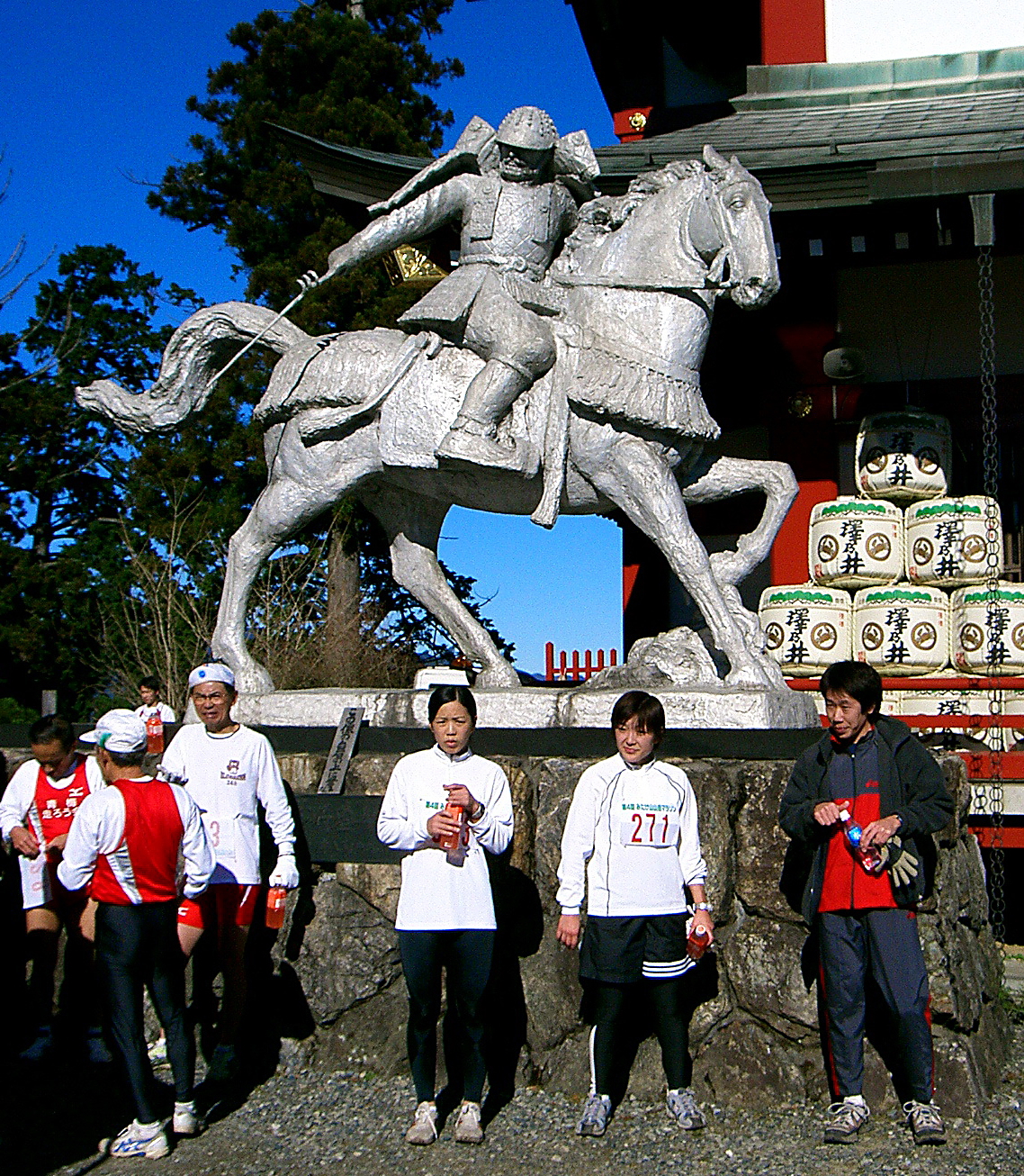
GAMBARE! Run! Lunge up endless steps, gongs beating in your ears and stagger a last few paces as if through treacle. Book-keepers wait in judgement, a banner swims overhead- why can’t you read it? Higher still looms a huge silver warrior on horseback, sword poised to lop off the heads of those below. You want to shout, to warn them, but they can’t understand and you laugh manically as you sink to the ground. No, it’s not just another running anxiety dream and you aren’t loosing it. It is a Japanese mountain race … and that’s only the finish….

The finish is at Mitake-san's mountain-top shrine


Tokyo may excite the techno-urbanite, but it’s flat, it’s enormous and it’s very, very ugly. (Even I think that and I come from Rochdale.) Sanity demands that the fell runner gets the hell out. Fortunately, most of Japan is covered by beautiful mountains, some of which are only an hour to the west of Tokyo. The modest spot heights and wooded trails with neat signposts are deceptive. This is forest you can fall off. Being geological babies these ‘hills’ are sharply ridged and craggy, suddenly requiring concentration after easy running. Mountains are venerated with the suffix ‘san,’ each with it’s shrines and offerings, each feature with it’s own god of place and a sense of awe befitting a land that can shake itself like a dog scratching fleas.

Running ‘off piste,’ even on these modest hills, is not a good idea, as I have found to my cost. Flesh-ripping scrub, funnelling down into dangerous gullies tends to focus the mind on navigation a little more. And when the animal warning signs depict snakes, hornets, monkeys, boar and bears, you start to hanker for something cute and homely, like an aggressive farm dog. Winter is the best season below the tree line, otherwise you might sweat up 3,000’ and see nothing but leaves - and in winter some of the wildlife is safely asleep.

Until this visit I hadn’t seen another hill runner or been able to find a race to run. I finally managed to get a late entry for the Mitake Mountain Trail Race in November, the last of the season. A recce revealed a fast 15k/2,500’, very runnable course, with two thirds of the climbing on tarmac in the first 4km and a mountain top finish.

Early morning on race day found us shivering at the Mountain railway start. The entire field duly lined up, not to run, but for a full half-hour of synchronised group aerobics! We are talking Lycra clad women instructors with a sound system here. They all looked to be enjoying it but it was a star jump too far for me.

Pre-race exercises anyone?

According to the organiser’s map there was one short, rough technical downhill stretch to look forward to on the course, which mainly climbed, but I was stunned to find a ‘No overtaking’ instruction on this section! Hell, descending is the only thing I can still do. After clarification it seemed that overtaking was acceptable, provided permission was politely sought from other runners—this reprieve interrupting the rather less than polite string of epithets in my mind.

After photos with a splendid man in his seventies running with a flag calling for peace in Afghanistan; and another with my wife's uncle (clad in full black motorbike leathers set off by a girl’s borrowed fluffy blue hat) the start was called. The only other ‘Gaijin’ (foreigner) grabbed me and said hello, then we were all off to the beat of a large Taiko drum, the leaders disappearing round the hairpins, led by a forestry safety worker on a motor-cross bike in bright red leathers (but sadly no fluffy hat.)

The start, with the winner in yellow

Pacing yourself up a 1,000’ climb on tarmac is tricky and the second half on trails was spent hanging on, being passed by the odd runner—they were all thinner and more poshly dressed than me—not difficult on both counts, so perhaps I was the odd runner. Still, the sun striped through the trees, the air was crisp and good, the first time up the steps of the shrine was a novelty and the waterfall sparkled beneath pine-topped cliffs. Finally I was mountain racing… in Japan!

Things were getting painful by the bamboo fringed ridge path heading back towards the shrine, with runners chatting as they trotted by. I was looking forward to the short downhill section. I let my Walshies do the talking as I hit the descent, scattering gravel and sticks and shouting polite apologies to the string of somewhat shocked runners who kindly (and sensibly) got out of my way. I think it was their first encounter with English style descending.

Allesssandro nabbed first gaijin kudos by re-taking me just before the finish on top of the shrine steps for 25th and 26th place from 300. I’ve had a slight ME induced dip in form of late…ok, ok, so it’s a seventeen year dip…so this was good enough.

Alessandro turned out to be a 26-year-old who had been in the Italian orienteering team as a junior. He introduced himself and invited me on a run with his Japanese club before disappearing for the onsen (hot volcanic spa bath,) which came free for all finishers, along with a sweatshirt and numerous spot prizes.

I chose the English option—stay dirty and eat lots of food. Hot noodles in the sunshine; panoramic views across the hills to the vast plain of Tokyo greying to nothing in the distance; oh yes, that'll do nicely. Pushing our son back up the hill in his buggy for the prize-giving at the shrine: oh no. Entertainingly, most of the prizes were decided by an innocent, mystifying and protracted communal game resembling ‘paper, scissors, knife,’ with groans and cheers all round. Passers-by became embroiled and even got prizes. "Jan, ken, PO!"

That night saw us at home, being presented with an enormous celebratory strawberry and cream cake by my wife's uncle. He is affectionately known as ‘Mr Cakee’ for his custom of bringing ever-bigger cakes at every visit. On the top was the legend in chocolate ‘Have view of next champion.’ You’d need a bloody enormous pair of binoculars, mate.

With Alessandro on a later run in the mountains west of Tokyo from Ome


The club run a week or two later was a stonking three-and-a half hours which got faster and faster as slower runners peeled off for shorter routes, leaving a group of four of us, the pace being set by ultra-distance specialist and club captain Taku-san. He had finished 3rd in a 70k mountain race the month before despite his six-days-a-week, twelve-hours-a-day job. We played a game of ‘crack the newcomer’ as he eased the pace upwards at every rise and kept it there, drawing shouts and groans from Allessandro and a handy looking young Japanese runner. This felt faster than the race by some way but we finished together so I managed to keep my dignity and granite-hewn northern silence.

I learned on further runs that shouting ‘Itai, itai,’ (it hurts!) or ‘Damei’ (stop it!) is traditional and if Alle’ is anything to go by, with Italians too. Such ritualised groaning is not to be confused with actual exhaustion—they don’t slow down! At one point Alle’s groans were such that I expected to turn round and see him holding a baby.

Trail running on Hinode-yama Tokyo Japan
Training with Taku-san and Alle on Hinode yama, with Mitake-san behind

Another slight difference from the average British club-run was getting naked in the onsen together afterwards. There really is no better way to finish a winter day on the mountains! After one previous memorable snowy walk we sat outside, up to our necks in steaming water beneath a huge mountain moon. On a hot summer night I have had a small, unfenced campsite onsen to myself at midnight, looking up into the trees with increasing nervousness as I realised the lack of any barrier. I was a ready to eat boil-in-the bag bear snack.

All things must end, and an ill-advised half marathon along with 8,000 Tokyites a little later (flat, dull, windy with a sandstorm in the finishing field) saw me injured once again… bugger, and I was just starting to enjoy myself. Ah well, back to limping overweight and half-trained through the mud and sleet of an English ‘spring,’ back to sloshing off in a cold stone horse trough, back…home.

This article first appeared in the UK Fellrunner Magazine in 2007

24/07/2012

Mt Kongo Climbing Challenge Trail Race, near Osaka, Kansai - April

Mt Kongo, south of Osaka - seen from Katsuragi-san


35km, 2,000m of climb and descent on fast runnable paths (22 miles / 6,000ft) 2012 winning times: men 3.14.45 (439 finishers), women: 4.44.18 (83 finishers), veteran men over 45: 3.59.12 (307 finishers). Total finishers: 829 (1016 starters).

I seem to be making a habit of ending up in the last group to start in 'wave start' races - an especially bad idea when there is a walking event tagged on to the race. 35km of trail filled with walkers and runners adds up to an awful lot of overtaking and apologising (around 2,000 times!), so if you know the route, get there really early and go in the first group off - I tell myself....again! Most of the front runners were in the early starts, though I'm impressed to see that some fast times were done from the back, so it can be done.

One of the last groups of 50 to start
Kongo-san is the name used for a well known and often walked group of mountains on the south east edge of Osaka. The ridge is not particularly interesting or dramatic, and the paths are fast and runnable, with most slopes covered in pesky steps. No doubt some of paths on the flanks are more testing and attractive. The race, the 38th Kongo Climbing Challenge, started at the small park 1km NW of Nijojinja station, went over the saddle just south of Nijo-san, then joined the main ridge over to Mt Katsuragi, Kongo-san, and the ridge heading south then south-west from there, before descending into the valley to the north and following the road to finish at Anami station.

Full of people on race day - keep to the sides
I jogged the course slowly the week before (and took the following photos) - and was passed by a whip of a runner steaming along at race pace - I guessed he would be in the first few come the day. He wasn't for chatting and flew past which emphasised the bad day I was on - cheers mate. It was good to know where I was going and how quickly to start, though I still had to ask at one confusing junction. Before answering the two young women I asked cried out 'Sugoi! Samui desu ka?' (Fanatastic - aren't you cold?), which is compulsory when faced with a foreigner in shorts and a vest when most are still wrapped up.

Mt Katsuragi 968.9m - good views from the top but not much to look at

Having checked the course makes it seem to pass more quickly in the race. It also taught me that on the uphill stepped sections it was often quicker and easier to find trods through the trees to one side. One way or another I was passing people all the way, and feeling good in the fresh sunny conditions.

A concrete and dirt road leads up this valley towards Mt Kongo, 1,125m
Although the course has 2,000m of climbing a lot of it is in undulations, the main climbs being up onto the ridge, up Kasuragi-san, and up Kongo-san. After Kongo-san there is very little climbing and the path gets more attractive as this section is less walked.

Steep stone steps around half-way - tricky when full of nervous joggers and walkers
There isn't any technical terrain, and the only steep rough section with stone steps was so full of people it was hard to let rip, and a marshal was there warning us to be careful (aw, sweet). I gave it a go, though, as is my wont, and put the wind up a few nervous souls. If they ever organise a championship series in Japan they would have to select race only events - walkers really cramp your descending style.

Gentle joggle checking the second half of the course, with bear bamboo
After Kongo -san I had worked through the field and thankfully it got a bit quieter, with mainly just runners to pass on the increasingly pleasant and less engineered paths, sometimes on springy leaf litter with dappled sunlight. OK, time to get going.

Run me, run me...
I was feeling good now, having paced myself correctly, and enjoyed pressing on, using each group I came up behind as a target. I caught up with a guy I had chatted to on the train on the way there whose start time was half an hour earlier. "Let's run together - two people are faster than one!" he said. That's sometimes true, but I was on a roll and sadly he was soon out of the back. Sorry mate. I concentrated on working hard uphill on the small undulations along the last ridge, knowing that the descent and road run-in would be OK whatever state I was in.

The final ridge SW from Mt Kongo
I was looking out for the turn sharp right off the ridge, and found that fortunately it was the one I had reccied the week before. Jumping down huge steps fit for giants made for painful thighs, but once on the valley road it was just a few kilometres blast to the finish. Everyone was lounging around in the sunshine, and I bumped into the guy I had run part of the Mt Rokko race with 3 weeks before. He turned out to be a hard-working fireman. A couple changed from their immaculate running gear into their immaculate going home gear, carefully brushing their already clean shoes before walking to the station.

Most of the course seen from the East
I waited for my friend Richard to finish his first ever race, which he duly did in good form. He was excellent entertainment value on the way home, as he experience his first ever leg cramps. Unfortunately for him this happened on a train carriage full of unsmiling and formal looking people. He suddenly arched his back with a shocked look on his face and lurched to his feet, proceeding for the next 10 minutes to execute what looked like an experimental modern dance exploring the tragedy of the human condition, whilst asking "What is it? What's happening to me?" through gritted teeth. He was bustin' some serious moves. I know how excruciating cramp can be, but his simultaneous attempts to look normal in the rigidly conformist context of the Japanese train, not cry out and explain to the stony faced passengers in polite Japanese that he wasn't ill, he had just done a mountain race (which I think they took as proof that he was indeed mentally ill), made keeping a straight face difficult. My normal way of helping someone with cramp, which would be to throw them on their backs, grab their heels and shake, followed by massage, would probably not have helped the situation. The cloistered sanctity of the railway carriage must not be disturbed. Apparently.

Later the results and an unusually tasteful race shirt arrived (no sponsor's logos, hooray!). I finished in 4.31.18 for 13th in the V45 race from 371 starters (7th V50 if they had that category), which overall was 60th from 912 men starters.

The Mt Kongo Climbing Challenge Race takes place in early April - enter in advance through Sportsentry. For race organiser's website click here (Japanese)

18/03/2012

Ist Mt Rokko Juso Race report

Trail race 45km/3,000m (28 miles/10,000ft) Kobe, Kansai, Japan
Red Lights in the mist

Well that was very interesting, to say the least. So many things I have never seen before in a long mountain race - some entertaining, like the woman who finished in still pristine make-up, wearing what appeared to be immaculate full 1980's disco gear including a skirt, tights and shocking pink leg-warmers, all topped off with a plastic mac. She did a decent time, too. Hats off to you madam, I always end up with panda eyes and sparkly tights round my muddy ankles when I go for glam in trail races. One or two novelties I'd be happy not to see again too soon, like queueing for a checkpoint stamp, amongst other things not involving actual running. My legs hurt and I have that 'day after a long race' feeling - hungry and thick headed with scary forehead veins and screaming skull eyes, but deeply satisfied - so something must have gone right.

The finish of the Mt Rokko 45km race in Arima Onsen - that's the time of day, not the elapsed time

Perversely, I was delighted to see the weather forecast was bad, and the first third was in heavy rain and wind, the 'real feel' at about 10c. Just a normal day at the office for an English fell runner, but not much to the liking of the average Japanese person. Not that trail runners are average - racing 45km with 3,000m of climb and descent (28 miles/10,000ft) is something of a specialised taste, but everyone was pretty wrapped up. Quite a few were wearing full length disposable plastic coats over their gear, as if in a last minute panic at the 'extreme' conditions - the first of the day's firsts. I decided that getting dehydrated was worse than being chilly and gambled on it getting warmer, raising a few eyebrows by setting off in shorts, thermal and pertex top, which proved to be right for me as I never felt cold, although there was a bit of ice around above 800m and it got a bit blowy. They will all have the last laugh when it gets hotter though. They will all be trotting along with nerry a bead of sweat in the summer, while I lie down, a crumpled and soggy mess of crimson heat stroke.

As predicted, the wave start was frustrating and even dangerous, as setting off last meant that the first  30% of the course was choked with runners, which provided a strange combination of being slowed down and frustration-induced adrenaline. I'm not sure if it made me push too hard or kept me to a sensible pace, but it felt weird. Not as weird as the controlled sections though - having to walk off the first hill on steps with no overtaking allowed, knowing that the first few through would have been running, was galling, followed by walking through a shopping street. Stewards were watching to disqualify anyone not complying. The most dramatic section of the course is the steep crag coming of Yokoo-san. There was a queue for this walking/no overtaking section, and again people starting in the first group would be quicker. I would usually look to pass a lot of people on this kind of terrain - not today! The second climb is a big flight of concrete steps, and threading past all the people strung up it took a lot of apologetic 'sumimasen' s.

The finishing tape for every runner was a nice touch

Releasing some frustration by blasting down the next descent felt good - until I got to the first of four sets of traffic lights on the route. Red. The wait of several aeons and a millennium gave all the people I'd passed time to catch up. Bugger. On the plus side, the next mountain had time to be eroded by 5cm.

The great thing about having run a course check beforehand is that on the day it all seems to fly by much more quickly, and the next few hills, mainly on one kind of step or another, didn't seem so bad. The field was thinning out now, and I had caught up the people going at my pace. Two more red crossing lights ("This is getting silly, is my race IC chip switching them from green?") and we were on to the long drag up Mt Maya, we had broken the back of that 10,000ft of climbing, and we were into the mist.

Running alone for long stretches now, more concentration on route-finding was needed despite the organiser's extra signs, but having seen the route before helped in reversing a potentially disastrous mistake - there are endless path junctions. I called back runners who were heading the wrong way several times. I buddied up with a young guy in orange that I kept seeing who was stronger on the climbs and slower on the descents and we ran the fast road section to checkpoint four together, time for one last red light, and off along the caged paths through the golf courses, until a sore leg slowed him down. I was slowing down too, loosing concentration after five hours running, keeping a dodgy stomach at bay and getting passed by a couple of guys who had paced themselves more evenly and knew where the finish was. After a few undulations and more steps threading the road Rokko-san top itself seems to come quicker than expected, and I felt I could have emptied the tank a bit more. Time to do just that.

The finishing descent is fun -  fast, then getting rougher. I passed two runners who had stopped to refuel at the last checkpoint - thanks lads! Then another, and a tall young guy I'd chatted to earlier while queuing for one of the walking sessions earlier, who seemed to be ambling along looking at the trees. Well they were nice trees. "It's only 2km to the finish you know! Let's go!" I called, in case he didn't know. "Oh, be careful!" he replied. Erm...I don't think so, sir, more than enough control for one day methinks. This came out as a shouted "No!" A well-meaning marshal on the way down also told me to be careful before the rough section down a small steep-sided valley. The tank was well and truly emptied now, and the small climb near the end made sure I left it all on the course.

The finish was well organised, with a gantry, big clock, a tape for every finisher, and even, comically, someone holding up a card saying "You are looking good!" I think not. I needed a few minutes sitting down before I could face getting changed, which took a while - if you have done a mountain ultra you will know the feeling. Feeling half-human again I collected the certificate with time (5.46.08) and position (18th from 485) though I don't yet know how I'd done in the 45+ group. The winner took 4 hours 53 minutes. Hell, with my medical history and age (53), I'll take that. Still, we all have to take our times with a pinch of salt what with the lottery of queuing, red lights and all.

Hello, is there anyone there?

All that was missing was a bit of post-race banter and socialising. Like most of the races I've done in Japan it was just finish, get changed, and well....go home. Nobody talks much. English fell running is such a great social scene book-ending the races, starting with protesting about how unfit, untrained and unwell you are, and usually ending up with talking crap and swapping war stories in the pub afterwards. There is a shared history and everyone knows everyone else. So it felt a bit lonely, phoning my entirely underwhelmed family to say I'd survived and then wandering off to catch the bus. Still, that's what blogs are for isn't it, you know exactly why I feel so satisfied, don't you? There, I knew I could count on you.

Having found my way over 45km of mountain, I couldn't find the bus, until a sprightly gentleman of seventy seven, as he proudly told me, said he was going to the bus himself and showed me the way, and quite a way it was too, I would never have found it. He said that now he was retired he likes to take children walking on the mountain. When we got to the bus, he didn't get on, and I realised he had come right out of his way just to help me. So I wasn't the only one to have gone the extra mile.

My number, after it had been through the wash by mistake - makes you want to run, doesn't it?


The Mt Rokko Longitudinal Race (45km / 3,000m climb) takes place in mid March. See my previous posts:
Rokko course pt 1
Rokko course pt 2
Rokko race rules
It is organised by Actrep.

07/03/2012

Rules rule?

An example of rules in Japanese trail races: Mt Rokko Longitudinal Race 

Fell running. The freedom of the trails, the one area of life where yo are free to let rip, to rediscover your animal self on the mountains beyond the narrow nit-picking bounds of modern life, right? Well, not quite.

A nice fat white envelope arrived from Actrep, the organisers of the Rokko Longitudinal Course race (45km/28 miles with 3,000m/10,000ft climb). An essential part of trail and mountain racing in Japan is making sure you understand the exact format and multiple rules for a particular race, as there are no agreed standards . I retired with a translator friend to the chain restaurant, queasily coloured an intestinal orange that makes you feel as if you are being digested as you eat. It has all the effortless charm of a motorway service station, but it is cheap and there are no locally run alternatives. Oh for the Red Lion in Littleborough. So, what is on the race menu for a week on Saturday? Let's work through the race information. Take a deep breath.

'Wave' starts
Firstly, as number 561 of 600, even though I entered very early, I am leaving in a 'wave start' at 9am. 50 people at a time start every 3 minutes from 8.30. This means someone in my group running well might have to overtake 10 people every 1km, or one every 100 metres (450 people over 45km). If it slows you down by at least 1 second to overtake someone - if you are lucky - that means you are giving a minimum of around 6 minutes to a rival starting in the first group. Not good. I'd prefer a mass start, asking people to be sensible about their position, with a loop to string people out to start. Route finding shouldn't be a problem though with that many people to follow...

Improvised and official signposts, map reading, or just follow people?
Special sections.
There are designated sections where....you might want to sit down to prepare yourself for this one.....you have to walk. Yes. There are sections where you cannot overtake. I nearly had a seizure in my first Japanese race when I saw that overtaking was not allowed on the only steep rough downhill section! I got permission from the organiser to overtake as long as I politely requested to do so from my fellow competitors. I mean, descending is the only thing I can still do!

For this race, it goes like this:
  • Section 1 - downhill steps: you can run but there is no overtaking. Someone will walk, so basically you are screwed. The leader of the first group to start will gain 5 minutes.
  • Section 2 - urban pedestrian walkway: you have to walk, but overtaking is OK. Do the hip-shake thing: practice race-walking now.
  • Section 3 - mountain crag with some exposure: you have to walk and there is no overtaking. Nullifies the skills of rough stuff specialists.
  • All urban sections: 'jogging only.' All traffic signs have to be obeyed as usual, meaning if a pedestrian crossing is on red you have to wait, even if the road is empty. This can work for and against you. Maybe if I time it right I can recoup that 6 minutes. For most runners jogging won't be a problem on a race of this length - and what is it anyway? I don't fancy trying to keep up with Paula Radcliffe's jog.
Perhaps these rules are in response to police, local government and insurer requests, with a touch of organiser wariness thrown in. Anyway, it only covers 2 or 3km out of 45. We'll live.

Equipment
No rules! That's right, no minimum clothing, kit or food requirements. Feeding and navigation is the competitors' responsibility. You get a nicely printed map free - but if you want to orienteer by compass you will need to draw your own grid lines on as there aren't any and north is somewhere up in the top right corner. This is a well used route near to roads and civilisation, but I will be carrying at least a waterproof top and bottoms, and I would always say full body cover must be carried. Mountains are mountains and one wrong turn and a broken ankle could see you in trouble. Viva FRA rules! There are drinks machines, shops and cafés on the way - lighter than carrying liquid.

Checkpoints, end points, and another kind
OK, this straightforward. There are three kinds of points on the routes: 5 end points in case you need to drop out, 3 checkpoints that you need to get your card stamped at, and another kind which we don't yet understand. Some checkpoints are also end points, but not all end points are checkpoints. Endpoint 4 could be checkpoint 2. Then there is the other kind which we don't understand yet. Got that? Good. Now can you explain it to me?

Cards
There is a card that must be taken to sign in with, then we will be issued with a card which must be stamped at the three checkpoints (fun if it's wet) and handed in at the end, and another card which we don't understand yet.


So.....
It's all very interesting. There is a high tolerance for rules and administrative detail in Japan, so local runners won't bat an eyelid at all this. Being used to the UK fell running scene I'd prefer to see minimum rules and runners treated as responsible adults. I would, I would, I would! (Sound of toys being thrown out of the pram). In 30 years I have never seen a runner endanger either another runner or a someone out walking their dog. Mountain people look after each other, right?

Safety has to come first though. And, having organised races myself, I am well aware of the hard work that goes into it and all the different pressures that end up giving the race its particular character. As a runner I really appreciate the chance to see what will happen when I push myself alongside others. It's all good. Let the slightly constrained fun begin!

02/03/2012

Mt Hiei and the marathon monks, Kyoto

Mt Hiei just north east of Kyoto in late December
I didn't know until we were on the mountain that I would be coming into close contact with one of the world's great historical mountain endurance traditions. I had read about Mt Hiei's 'marathon monks' but never thought I would see the place - especially by accident.  In a gloriously incongruous transplanted cultural tradition I had been invited for a Christmas Day meal, sleep-over and long Boxing Day run by David, who I had only met once before - oh the joys of spontaneous sociability! Ohara was snowy and beautiful, and it felt like being at home back in Fukushima's mountainous Okuaizu villages.

Ohara morning - only 10km north of Kyoto

Run preparations were of Olympic standard. Well stuffed with the a western-style meal, refreshed with long conversations in English and slightly pummelled by David's great kids acting out their favourite animé scenarios, Boxing Day dawned with more snow. Let's get at it.

David heading up the first climb in Northern Irish  hard man style  - gear is for wussses

It was only now as we climbed gradually up the first hill in pristine shallow snow that I understood where we were going - over a couple of tops to Hiei-san. We would be running in the footsteps of the 'marathon monks.' Wow, I'm not worthy. Nah, not really, I'm too much of an egotistical sceptic to feel that. But it would be very interesting. We made the top of Yokotaka-san and made our way along the undulating ridge, ribbons of ice coating every twig, and a stiff breeze cutting over the hill. "It'll harden ye," said David with a wry smile. In a homage to Michael Jackson he had managed to come out with only one glove, and he explained that "It'll harden ye" is a stock response to any hardship in Northern Ireland, where they have known a few.

Ice decorations and David in his element on Mt Yokotaka
We were the only souls out - it is a normal working day in Japan, so we had the new-made world to ourselves, slithering, leaping and whooping down steep slopes. As we approached Mt Hiei David told me what  he knew of the place, that the Buddhist temple and it's army (yes, Buddhist mercenaries/soldiers, but if you think that is weird, check out the Yakuza scandal, links below), had got ideas above it's station and interfered once too often in the affairs of the capital in Kyoto, with the result that a large imperial force was sent in 1571. It encircled the mountain and neighbouring towns and then moved upwards, killing everyone (an estimated 20,000) and burning everything until it reached the top. Problem solved after a fashion. The temple was re-established, and the tradition of a gruelling discipline of mountain endurance and prayer resumed.

Part of the monks' prayer and endurance route
After exhaustive research spanning several minutes in the dusty tomes and darkened recesses of the internet, I have gathered the following. I'd take the details with a pinch of salt if I were you, as most sources say something slightly different and seem to be feeding off each other without looking at primary materials - and I'm doing the same.

They are sometimes called 'running monks' but this seems to be inaccurate. "Jogyozanmai" is translated on an information board I saw as "walking meditation" rather than running, and the films (links below) show fast walking  - so no, it is not that kind of jog! However, anyone who understands mountains knows that one person's fast walk is not the same as another's. The walking is incidental in that it is primarily there to gain access to the numerous prayer sites across the mountain. The difficulty of the Jogyozanmai lies not in its speed, but in its relentless succession of hard days in sets of one or two hundred, over seven years, amounting to an estimated 28,400 miles, set in the context of prayer and meditation, sometimes with limited food and sleep, no modern comforts, and all done in grass sandals through any weather and illness, come what may. Very few have completed it, though some have done it twice, and good runners are reputed to have given up after a week.

I have a feeling that English running greats Joss Naylor and Billy Bland would not have had a problem with it, mind you. Clearly, it is very different as even hardened mountain runners used to long distances have flexibility and fit their running around the pleasures of ordinary life, resting when they need to, and choosing when to suffer. It seems to be the unforgiving rigidity and emotional isolation - the intentionally soul destroying boredom even - of the Mt Hiei discipline that makes it particularly difficult - one day of serious illness and the whole thing is in jeopardy.

Jogyo-Do temple on the left, Hokke-do on the right, for walking, and walking and sitting training respectively. I'm looking for the cake eating temple
There is a wide continuum of human experiences that connect up with recreational mountain running and mountain asceticism. Both can span meditative thought, a quasi-spirtitual (in the sense of awe and wonder) relationship with the land and existence. Is there a point where both touch on the dysfunctional self (present company excepted of course) escaping the difficulties of ordinary life, or even a need for the kind of intensity that borders on self-harm? In case you think that is an exaggeration, the monks carry a rope and blade as in previous centuries they were supposed to top themselves if they failed, and the route is said to be dotted with the graves of those who have. Generally speaking when I fail to finish a run I have a little moan to my friends then go home and have some nice beans on toast - but then again, I am not enlightened. The long ordeal finishes with a 7 (or 9?) day sleepless fast where death, slash, enlightenment is hopefully approached. It used to be 10 days, but most people died so they shortened it, the softies. Imagine getting to the of it all end and feeling, well, no different? I know the Mt Hiei experience would not be for me unless all else had failed....erm...where do I sign? As David would say, "It'll harden ye."

Excuse me, is this the café?

Information on the marathon monks and Mt Hiei on the internet is patchy and often slightly contradictory: the truth is out there somewhere....
20 minute Australian video on the marathon monks
English documnetary (older film, different monk):Pt 1
Pt 2
A slightly wacky page on the marathon monks
USA today article 
The masacre on Mt Hiei
"The Marathon monks of Mt Hiei" is a book by John Stevens
Wikipedia page
Enryaku-ji temple and the yakuza scandal 
Warrior monks

19/02/2012

Mount Rokko Longitudinal Course pt 2

The spurs and flanks leading up to the Rokko ridge are much better than the ruined ridge itself

Rokko-san above Kobe is a mountain ruined by development. In the absence of planning protection it may be inevitable for a mountain so near a city, but the ridge itself is ruined for long stretches by roads, strings of very ugly buildings and attempts at tourist business. Many of these were probably built in the bubble economy period and never had any chance of making money - and with no thought of dismantling them or rehabilitating the site afterwards. I will spare you the photos as I couldn't bring myself to take any. Fortunately the sides are too steep and rough to do anything with, and there are some great paths on the off-lying tops, spurs and side valleys  that are well worth exploring.

I wanted to check out the second half of the 45km race I am doing on March 17th, which follows the 56km route from Sumaurakoen station on  the Sanyo Dentetsu line to Takarazuka station to the north east, with about 3,000m (10,000ft) of climb and descent over 16 peaks. See here for part 1. The race misses the last 10km section and from Rokko-san itself drops left, down to a park in Arima Onsen.

Cage running: a mountain running first
The 650m (2,100ft) climb up a ridge from Rokko station on the Hankyu line was wild and great until we hit the first concrete monstrosity NE of Mayabatou-san. The next 10km or so to the top of Rokko were easy but not a pretty site - though the roads are good for families with young children and older people to get access to somewhere high for an easy walk. Running through one is as near as I ever want to get to a golf course, but at least there was no chance of getting brained by a well driven ball as the path is enclosed with a netting cage - a curiously zoo-like experience.

WTF? There is a place for ugly monumental sculpture. This isn't it.

The wire netting theme was continued by the enormous.....I'm struggling for a category here.....let's be charitable and call it a thing, seemingly a lighthouse in a chicken coop on a Wagnerian scale, perched proudly on the ridge. [update: a reader has kindly pointed out that it is a wind sculpture consisting of hundreds of flutes that sound beautiful in the breeze] At least when you are mountain running you can get past such aberrations quickly, and in fact this whole section to Rokko-san was easy, in contrast to the repeatedly stiff climbs in the first half of the full 56km course.

Top of Mount Rokko 931m
I checked out the race finish with an hour's quick blast down to Arima Onsen and back up. This confirmed that the side paths and valleys in this area are great. My companion Keisuke-san very sensibly read the paper over a bowl of udon in the cafe just below the top of Rokko-san instead. We then began what proved to be the very nice end section of the main route. We quickly left the dross behind and began the long fast path that contours along a very quiet undulating ridge towards Takarazuka. Ahhh - no roads or paved paths, what a relief!

What a relief - lovely views in places, and not a vending machine in sight
It was a surprise to find this section so pleasant, but be warned - unlike the rest of the Rokko Juso, there is nothing along this last 7km section but trees, so if you need liquid or food stock up at Rokko-san. Also, the small green signs go AWOL when just when you are looking for the entrance to the ridge path from the road, so take care. 800m from the Rokko car park the path seems to go up a small rise to a shrine, but you need the path that heads NE from a loop of road below - so keep left on the road. If you have done the whole route it would not be a good time for a detour down the wrong ridge.

Lovely easy running towards Takarzuka
If you are feeling good this must be a nice path to really let rip on. Whoever laid it out knew what they were doing as it contours beautifully, with the odd rise as it gradually descends - it felt longer than it actually is though, just because it is so quiet - on this cold February day anyway. Or was it the several hours with a full rucksack that did it? A steepening descent brought us out above Takarazuka. On my map it is all a lovely green, leading me to expect something rural. But no, it is part of the urban sprawl of Kobe which laps all around the skirts of the mountains, and pug ugly. Grey would represent it better. Running into the first tall blocks of flats hemming in the roads was a slap in the mug after the woods - and dammit - no change of clothes or towel, so we had to give the onsen (hot spring bath) by the concrete rimmed river a miss.


The towers of Osaka from above Takarazuka
So in summary, now that I've seen the whole course, I would say the Rokko Mountain Longitudinal Course is worth doing if you live nearby and take it for what it is. The first half is hard,containing most of the 3,000m (10,000ft) of climbing, and the second easy but you need a map and to take care all the way - don't rely on the signs. The sides of the ridges provide some paths on challenging and beautiful terrain with epic cityscapes behind, but the main section of ridge from 10km SW of Rokko-san to the top is best avoided unless as part of the whole course, but after that it improves again.

26/01/2012

Running the Yata hills, Yamatokoriyama, Nara

Japanese Cyclocross Champion 2012 Yu Takenouchi pretending to be tired, with Masaki and his boss

The Yata hills are small and easy but very pleasant for a gentle jog or some speedwork. I was introduced to them last October by Masaki-san, a trail runner and mountain biker whose local running patch they are (he has asked me to point out that they are often too crowded for MTB riding to be safe). He kindly arranged a run and family picnic and invited some friends along. As well as his boss, there was Yu Takenouchi, whose puppyish demeanour belied world-class racing ambitions on the European Pro Cyclocross and road scene. Since then he has won the Japanese national cyclocross championships in January 2012 and finished 33rd in a cyclocross world cup race - no mean feat. As I write he is preparing for the World Championships in Belgium this weekend. The boy is only 23 and he is going places. Fortunately he had come 3rd in a national MTB bike race the day before, and had never been trail running before, so me and Masaki were able to whup his ass! Probably the last time that will happen. Ever.

Yu and me (see what I did there?) and bossman. Yes I was hot.
The hills run from north to south for about 10km and there are a network of good fast running trails all over them. Seen in the photo above, a wide 'maintenance road' runs over the spine, with smaller tracks running off, and it is probably possible to string together a route with more climbing in it by using paths up the sides.

View from the Yata hills east across Nara city

A run in the Yata hills can be nicely combined with a family or group day out, as there is a pleasant park area with a big grassy area for picnics and for the children to play in - marked on some maps as the Yata Prefectural Park, but by signs on the hills as the Children's Forest Play Park. There is also Hiyoru-ji temple at the southern end, a world heritage site, and Yamatokoriyama castle on the eastern flank, which has some impressive stone walls and moats. there are small stations all round, so access is easy. (see map below).

A run followed by a nice homemade picnic - now yer talkin'
I really appreciated Masaki-san organising this, as we had recently self-evacuated from Fukushima prefecture, and it was the first time I felt able to relax or run for a long time. It was great to see children and not worry so much about them. I wish them a long and healthy life. Masaki lead us on a pleasant hour's route, waiting every now and then for the other to catch up, and then we all had a good trough in the shade of a tree. I was just feeling all mellow and had changed back into my cycling gear for the ride home, when he announced another run. Blimey, with my belly full and my under-used legs twinging and tendons pinging I wasn't so sure. But who can say no this smile?

OK, OK, another run, OK....
Masaki-san is a busy man with work and family, and doesn't get enough time to run and ride his MTB, so I guess he needs to make the most of it when he can. This time we took a few less used paths and had fun on the downhills - Yu was interested towitness the glory that is UK downhill technique on the rough stuff and said "I will beat you downhill next time!" Bring it on baby.

Looking south to Ni-jo yama and the Kongo-san range from the Yata hills
It was interesting to hear about Yu's experience on the Belgian semi-pro scene, and how a few of the other riders tried to wind up with racist jokes. I explained to him about black 'humour', and how sometimes it is used as a weapon to make you angry and weak, and sometimes it is a sign of friendship - very confusing. I told him some of the strategies that had helped my daughter survive the other girls in her English school playground, and if you can survive that, the peloton should be a doddle...

Yu Takenouchi texting his coach about why he had just risked his season on the turn of an ankle

Click for map of Yata hills